Via Adrina – The “Panoramic Path”
Through pastures, meadows and forests – always overlooking the River Eder
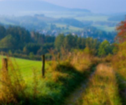
The circular hiking trail leads through the Rothaar mountains, offering fantastic views of the River Eder's floodplains along its 21-kilometre route.
Even experienced hikers need to plan to take more time than usual for this 20-kilometre route through the Siegerland-Wittgenstein region. This is due to the many panoramic views offered by the winding River Eder, whose beauty demands the attention of hikers and the reason the route is known as the “Panoramic Path”. Beginning in Bad Berleburg, the Via Adrina follows the course of the River Eder, which has its source in the Rothaar mountains. This circular hiking trail runs in a figure of eight around the meandering loops of the Eder and can be split into two smaller circular trails almost equal in length, the Arfeld and Schwarzenau routes.
The Eder was once known as the “Adrina”
The route is considered one of the most beautiful in Germany and runs along narrow paths, wide natural trails and farm tracks, through pastures, meadows and forests, but nearly always maintains its view of the Eder. Hence the name: “Adrina” is the first documented name of the Eder river.
Those who wish to can combine a hike on the Via Adrina, which has been certified as a premium trail by the Deutsches Wanderinstitut (German Hiking Institute), with a trip along the Wittgensteiner Schieferpfad (Wittgenstein Slate Trail). Like the Via Adrina, these circular routes are two more hiking highlights on either side of the Rothaarsteig trail.