Teuto-Ems border route
Cycling along smuggler’s trails and old trade routes
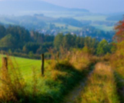
The circular route, which covers 150 kilometres, follows old smuggler’s trails and trade routes through the Münsterland park landscape and the Teutoburg forest
The Teuto-Ems border route follows old smuggler’s trails and trade routes. The path is around 150 kilometres long, running through the Münsterland park landscape and Teutoburg forest, and has been awarded four out of a maximum of five stars as a German cycling club (“ADFC”) quality cycle route.
The name of the circular route originates in an old border region, where three countries met, and where today, just two federal states border each other: Lower Saxony and North Rhine-Westphalia. Historical border stones and an information panel mark the spot where different areas of rule once met: The counties of Ravensberg and the Prince-Bishoprics of Osnabrück and Münster met here, and later, the kingdoms of Prussia and Hanover.
Palaces, castles, spa baths
Today, the route connects twelve cities and municipalities in two German federal states. As well as the brine spa baths of Bad Laer and Bad Rothenfelde, and the Kneipp spa town of Bad Iburg, the equestrian sport centres of Warendorf and the gingerbread town of Borgholzhausen are also along the way, as are Vesmold, the centre of Westphalian ham production, and the asparagus towns of Glandorf and Sassenberg, the historic Lienen at the foot of the Teutoburg forest and Osbevern in the middle of the Münsterland park landscape, the spice town of Dissen and the former mining town of Hilter, once famous worldwide for the “Hilter gold” ochre pigment that was mined here.
Another prominent feature of the area are palaces, where the neighbouring rulers attempted to outdo each other, and castles where they protected themselves from attack. These, and numerous other stories - such as salt smuggling between the salt mines of Bad Rothenfelde and the Westphalian ham producers - can be read in the “Grenzgeschichten” (“border stories”) brochure. The brochure is also available as an audio download online.
Two connecting routes make it possible to experience the circular trail over three days, covering distances of 48, 55 and 56 kilometres each. Due to its flat profile, the route is also well-suited for families with children. Tours lasting several days can be booked as a package, including overnight accommodation, baggage transfer and other extras.