Vechtetal route
From Münsterland to the Netherlands
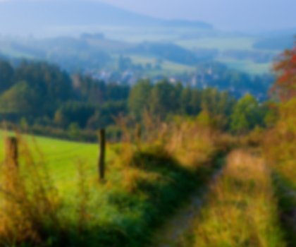
Heathland areas, moorland, forest and over 60 works of art along the way are what makes this route, which covers around 200 kilometres, and which follows the Vechte river from its source to its estuary, such an attractive destination.
The Vechtetal, or Vechte valley, route covers 224 kilometres along the course of the river Vechte, from its source in Darfeld in the Münsterland region to its estuary in the Dutch trading town of Zwolle. Varied landscapes and works of art along the way are a particular attraction along this route. Over 60 works by contemporary artists are freely accessible along the trail.
One of the first stops in the Münsterland region is the artists' town of Schöppingen, which with its image of the Mother of God from the Middle Ages attracts around 80,000 piligrims every year. From Nordhorn, the Vechtetal route leads on to the Kunstwege (art trail) route, which is Europe’s largest open-air museum, with sculptures from a variety of different artists from all over the world. Limestone sculptures and large-scale photos, wall paintings and iron works, landscape projects and complex installations offer an exciting insight into the history of the regional culture and landscape, with art as the main theme.
Guided by the course of the river Vechte, cyclists travel through heathland, moorland and forest, past long canals, broad meadows and a total of 15 villages and towns on both sides of the border. On the Dutch side, the route passes through small, typical Dutch localities through to the former trading town of Zwolle, where the Vechte flows into the “Zwarte Water”, and thus indirectly into the IJsselmeer lake.