Kindelsbergpfad Landschaft Rothaarsteig © Sauerland-Tourismus e.V.

Kindels­berg Trail

A cir­cuit of­fer­ing ex­cep­tion­al views and his­tor­ic­al in­sights

The Kindels­ber­g­p­fad (Kindels­berg Trail) in Sieger­land-Wit­tgen­stein com­bines idyll­ic nature with in­form­a­tion on the re­gion’s min­ing his­tory.

The Kindelsbergpfad (Kindelsberg Trail) in Sauerland combines idyllic nature with information on the region’s mining history. The trail, which covers just under 15 kilometres and is one of the highlights on either side of the Rothaarsteig trail, leads along rustic forest tracks through nature reserves and numerous vestiges of mining history. It offers many spectacular views over northern Siegerland along the way. After walking a total of 6.2 kilometres, hikers reach the summit cross on the Martinshardt (616 m), which rewards visitors with its fantastic views and invites them to make an entry in the summit book for their efforts.

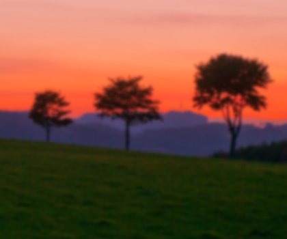
A view that stretches to the Siebengebirge

The next highlight follows 1.8 kilometres along, on the Kindelsberg, which offers hikers a great resting point with a restaurant, seating areas, a playground and a tower. In good weather and with binoculars, visitors to the Kindelsberg tower’s 20-metre-high viewing platform can also see the Siebengebirge near Bonn around 60 kilometres away. Incidentally, the tower itself is situated in an historic setting: it was once the location of a “refuge fort” which offered the people of the surrounding countryside protection from invaders.

Insights into the history of mining

24 panels along the Kindelsberg Trail provide information on distinctive features in the region, particularly its numerous mining pits. They are vestiges of the region’s centuries-long mining tradition. One example is located on the eastern slope of the Martinshardt in the Wilder Mann mining district. The last layer was mined in 1911, after which Wilder Mann was closed. Here, the circuit splits into two different routes for a short distance: hikers can choose to either continue along a wide forest path or take a narrow rocky path. Those who are sure on their feet can try out the rocky version. Along the mine road, it heads past heaps, relics of the mining industry and the former steelworks coal mine.

Map of NRW

Tour overview

Info, data & tour route

Google Maps is rendered here. If Google Maps is accepted, data will be transfered to Google Maps.

Accept Google Maps
Distance in km
14
Duration in days
-
Walking/Journey time in hours
4

Highest point in metres
608
Uphill altitude difference
466
Downhill altitude difference
467
Tour Level
Level of difficulty
intermediate
  • Round trip
  • Family-friendly
  • Wheelchair-accessible

Images and videos

Be inspired: images of your NRW

Kindelsbergpfad Fernblicke, © Natalie Glatter www.wandermagazin.de

More information

Discover it now!

Start point / end point

Kreuztal

/

Kreuztal

Type of tour

Insider tip

Contact

Touristikverband Siegen-Wittgenstein e. V.
Koblenzer Str. 73
57072 Siegen
Telephone: +49 271 333-1020
Fax: +49 271 333-291029
E-mail: tvsw@siegen-wittgenstein.de


Getting there

with Google Maps

Would you like to make an enquiry?

Please contact »Touristikverband Siegen-Wittgenstein e. V.« directly


Your contact details

I have taken note of the data protection declaration of Tourismus NRW e.V. and agree that the data I have provided may be collected and stored electronically for the purpose of contacting me.

Security question *

* Please complete this field

More hik­ing trails in NRW

Canyon at the Teuto-Circuits hiking trails, © Rudolf Schubert

Teuto-Cir­cuits

Read more
Roman Canal Hiking Trail - aqueduct Mechernich, © Natalie Glatter, Wandermagazin

Ro­man Canal Hik­ing Trail

Read more
Der Landweg ist einer der Bergischen Streifzüge, © Das Bergische GmbH

Ber­gisch Wan­der­ings

Read more
Kalvarienberg Alendorf, © Johannes Höhn

Eifel Trail

Read more
The river at the Neanderland Steig trail, © Kreis Mettmann Martina Chardin

Nean­der­land Steig Trail

Read more
Olsberg Kneipp Hiking Trail, © Dominik Ketz

Ols­berg Kneipp Hik­ing Trail

Read more
Winterberg High-Altitude Trail, © Ferienwelt Winterberg

Win­ter­berg High-Alti­tude Trail

Read more
wood figures at the Upland Trail, © Tourist-Information Willingen

Up­land Trail

Read more
River Sieg Nature Trail, © RadRegionRheinland e.V.

River Sieg Nature Trail

Read more
Sonnenuntergänge in der wie unberührt wirkenden Natur sind besonders beeindruckend, © Foto Oliver Franke / Tourismus NRW e.V.

Via Ad­rina – The “Pan­or­amic Path”

Read more
fog at the Ehmsen trail, © Julian Stratenschulte

Ehm­sen Trail

Read more
Wanderin fotografiert die Landschaft, © Joschka Meiburg

Cicu­lar Hik­ing Trails in the Maas-Schwalm-Nette Nature Park

Read more
Blick vom Hermannsdenkmal, © Teutoburger Wald Tourismus - OWL GmbH

Her­mann Heights Trail

Read more
Skulpturenpfade im Kreis Mettmann Kunstwege, © Stadt Heiligenhaus

Trails of art in Nean­der­land

Read more
Bergisch Trail, © Das Bergische gGmbH

Ber­gisch Trail

Read more
Old tree at the Hermann Trail, © OWL Marketing GmbH,S. Westermann

Her­mann Trail

Read more
Kleine Brücken führen den Bödefelder Hollenpfad über die Bäche, © Tourismus Schmallenberger Sauerland / K.-P. Kappest

Böde­feld­er Hol­len­pfad

Read more
Kleine Dörfer liegen auf dem Weg, © Uwe Völkner - Fotoagentur FOX

Way of St. James

Read more
Extertal Burg Sternberg, © Gemeinde Extertal

Hanseat­ic Trail

Read more
Sauerland High-Flyer - the view at the range of mountains, © Sauerland Höhenflug

Sauer­land High-Fly­er

Read more
the landscape on Brilon Ridge Trail, © Brilon Wirtschaft und Tourismus GmbH

Bri­lon Ridge Trail

Read more
break at the Ahrsteig, © www.ahrtal.de

Ahr­steig Trail

Read more
two people enjoy the scenery at the Egge trail, © Teutoburger Wald Tourismus

Egge Trail

Read more
panoramic views at the Bestwig Panorama Trail, © Reinhard Schmidtmann

Bestwig Pan­or­ama Trail

Read more
Die Usseler Heide ist Teil des Rundwegs, © Sauerland Höhenflug

Düd­ing­hausen Geo­lo­gic­al Trail

Read more
Kupferroute Bank an der Gedenkstätte, © Birgit Engelen

Cop­per Trail

Read more
Rambler at the Viaduct Hiking Trail, © Gemeinde Altenbeken

Via­duct Hik­ing Trail

Read more
Rheinsteig hiking trail, © Tourismus NRW e.V.

Rhein­steig hik­ing trail

Read more
Blick über die Landschaft - Rothaarsteig-Spuren, © Rothaarsteigverein e.V. Klaus-Peter Kappest

Rothaarsteig-tracks

Read more
Hängebrücke bei Kühhude am Rothaarsteig, © Rothaarsteigverein e.V. Björn Hänssler

Rothaar Trail

Read more
nrw-aktiv_radfahren_mg_0779_e

Ruhrhöhen­weg

Read more
Medebach Mountain Trail, © Touristik-Gesellschaft Medebach mbH

Medebach Moun­tain Trail

Read more
Upper Sauerland Ridge Trail, © Ferienwelt Winterberg

Up­per Sauer­land Ridge Trail

Read more
Hikers at the Wilderness Trail, © G.Priske

Wil­der­ness Trail

Read more
In der Natur finden Wanderer interessante Pilze oder Pflanzen, © Foto Oliver Franke / Tourismus NRW e.V.

Wit­tgen­stein Slate Trail

Read more
Kindelsbergpfad Fernblicke, © Natalie Glatter www.wandermagazin.de

Kindels­berg Trail

Read more
The Veischede Sun Trail, © IG Veischedetal

Veischede Sun Trail

Read more